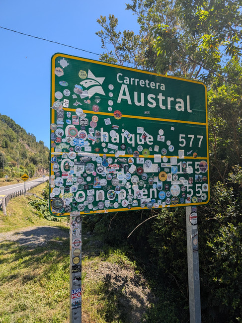
Driving the Carretera Austral (Ruta 7): The Ultimate Patagonia Road Trip Itinerary
- Mar 22
- 19 min read
The washboard gravel rattled our Toyota 4Runner as we wound past glacial blue rivers and jagged peaks, completely alone on one of Patagonia's most legendary roads. This was the Carretera Austral and it was everything we didn't know we needed.
Part of our Pan American adventure was driving the 1,247km down the Carretera Austral, which winds around, over and through some of Patagonia's best landscapes. Starting from the busy city of Puerto Montt and ending in Villa O'Higgins, one of the most remote towns we've ever been to, it really was a road trip of a lifetime.


We didn’t realise this stretch of road was going to be the highlight of our trip so we're here to share why you should add Ruta 7 to your bucket list, whether you're planning a rental car trip, part of a Pan American Highway journey, or bikepacking adventure.
The road, partly paved with long stretches of washboard and potholed gravel, gives a lifeline to the remote communities living amongst the wilds of Patagonia. You'll pass under volcanoes, beside vibrant rivers, and skirt fjords home to dolphins. It winds through 17 different national parks, with landscapes that shift from active volcanoes to temperate rainforest, the jagged peaks of Cerro Castillo, tranquil lakes, and finally the Southern Patagonian Ice Field.
This is the best road trip through Patagonia. Drive it in shoulder season like we did and you'll be alone but be warned, in summer it's crowded.
After 4 weeks winding from north to south, we've created this guide so you can plan your trip. From which ferries to book, what to see, how to prepare, basically all the nitty gritty.

Quick Overview:
Length: 1,247 km
Time needed: 2-4 weeks
Road: partly paved + gravel
4x4 needed? No
Ferries required: 3-4
Best season: Oct-Nov & Mar-Apr (Shoulder Season)
Start: Puerto Montt
Finish: Villa O'Higgins
Contents
Puerto Montt to Hornopirén & Pichicolo
The Ferry from Hornopirén or Pichicolo
Chaitén - Puyuhuapi (Futaleufú Detour)
Parque Nacional Queulat to Coyhaique
Coyhaique - Villa Cerro Castillo
Villa Cerro Castillo - Puerto Rio Tranquilo (The Marble Caves & San Rafael)
Chile Chico & Jeinimeni (Detour)
Rio Baker, Cochrane & Patagonia National Park
Puerto Yungay - Villa O’Higgins
Why You Should Drive The Carretera Austral
How Remote Is The Carretera Austral?
When Is The Best Time To Drive The Carretera Austral
What Is The Carretera Austral?
Things To Know Before Road Tripping The Carretera Austral
Ways To Travel The Carretera Austral
Ferries Along The Carretera Austral
Where To Stay on The Carretera Austral
 |  |  |  |
 |  |  |  |
Where To Stop On The Carretera Austral
Puerto Montt to Hornopirén & Pichicolo
The Carretera Austral officially starts in the city of Puerto Montt. This is your last base to get supplies, stock up on as much food as you can as it only gets more expensive with less choice (we ended up living off hot dogs and tinned tuna). It’s also a good place to get any fixes on your car (for our defender friends there’s a Land Rover specialist here) or pick up your hire vehicle.
Apart from that our advice is to get out of Puerto Montt as quickly as possible and head towards Hornopirén.
There’s a choice here, follow the 7 directly down taking the ferry from La Arena to Caleta Puelche, a quicker route but we suggest driving up and round to Cochamó.


Why take the detour?
Cochamó is home to some epic multi-day hikes including La Junta which is often called the Yosemite of Chile. There is also an awesome park up opposite Volcano Calbuco.
Apart from hiking this winding path takes you through some small, authentic fishing villages where you’ll see locals picking mussels, sea lions swimming and dolphins metres from the shore. For us this is a special part that shouldn’t be missed!
Highlights from Puerto Montt to Hornopirén.
Cochamó Hiking - La Junta and The Toboganes
Kayaking or paddleboarding on the Cochamó River
Soak in the Thermas del Sol
Dolphin Watching from your campervan
Small fishing villages

The Ferry from Hornopirén or Pichicolo
The second section of the Carretera Austral involves a ferry. There are two ferries which will take you to Caleta Gonzalo via different routes. We took the smaller, more local ferry from Pichicolo because it was cheaper for us, but share both options below for you to choose, or if one is booked up. This ferry gets busy, in peak season it needs to be booked a week or two in advance.
Hornopirén Ferry
SOMARCO
Two ferries + 15 minutes land crossing
Hornopirén → Leptepu (drive) → Fiordo Largo → Caleta Gonzalo
5 Hours
2x daily year-round + extra summer departures
This ferry leaves from Hornopirén sailing for 3 hours and 45 minutes to Leptepu. Here you disembark and drive 15 minutes across land before boarding a second ferry at Fiordo Largo that will sail for 45 minutes to Caleta Gonzalo. Here is where it gets a little confusing. Two trips a day are subsidized, meaning it’s cheaper, one trip is more expensive (added on in the summer months for demand)... try not to book that one.
Pichicolo Ferry
Naviera Austral
Direct
Pichicolo → Caleta Gonzalo
5 Hours
1 a day
The alternative ferry, the one we took, leaves from Pichicolo. This ferry is direct and you do not need to drive a section in the middle. The ferry takes 5 hours and leaves Monday - Sunday at 9am. As of 2026 they have added a new ferry here which may not make this route cheaper anymore.
Head over to Naviera Austral’s website here for updated prices and times.
The ferry we took was small but comfortable, there was free hot and cold water and electricity, until Mike tripped the switch! As you sail through the fjords, Volcano Michinmahuida will appear on the horizon, the road trip is just getting started!
Chaitén - Puyuhuapi (Futaleufú Detour)
After the ferry there’s very few places to stay before you reach the small town of Chaitén, this is because the ferry drops you off in Pumalin National Park which is also known as Douglas Tompkins National Park.
Here you can see the Darwin frog, although our friends paid to enter the park and were disappointed at the mown grass and unwildness of the area, leading us to skip paying the entrance.
We did however hike up Chaitén Volcano and recommend this to everyone driving the Southern Highway. It’s free and rewards you with views over the national park as well as a section through lush Valdivian forest and a few steaming craters.
The volcano last erupted in 2008 destroying the town below and displacing the 5,000 residents. They fought to return though and built the town you see today. There’s a few shops to stock up with supplies and don’t forget to fill your vehicle up here as well.
Note: Some people also start their Carretera Austral journey here after getting the ferry from Puerto Montt.


Once you leave Chaitén, there’s a long stretch south where you can take two detours, one to Futaleufú which we regret not taking and another to Corcovado National Park which involves a short ferry across.
We choose instead to carry on down to Puyuhuapi, stopping off to hike Sendero Ventisquero Yelcho. This is a hike to a glacier which is super accessible with boardwalks to access the first two viewing platforms.
As we reached Puyuhuapi we saw dolphins playing in the Puyuhuapi fjord and we recommend you visit the Termas Ventisquero. The town itself is small but picturesque with German architecture and German cakes (Kuchenladen).
Highlights from Chaitén to Puyuhuapi
Hiking Chaitén Volcano
Sendero Alerces (ancient 3,000+ year old trees
Cascadas Escondidas waterfall trail
Darwin Frogs in Douglas Tompkins National Park
Sendero Ventisquero Yelcho
Watching dolphins in Puyuhuapi
Termas Ventisquero
Detour: Futaleufú
Home to some of the best rapids in the world, Futaleufú is worth the detour if you have time. A glacier river winds its way through the valley where you can experience some pretty intense rapids!
Parque Nacional Queulat to Coyhaique
As you leave Puyuhuapi the first stop is the Queulat National Park, home to the famous Hanging Glacier (Ventisquero Colgante). Sitting enclosed by two cliff edges the glacier perches haphazardly on the edge, a thundering waterfall adding to the atmosphere.
Continue south through the Aysen Region until you reach the capital Coyhaique. A large town, with a lot of chaos we’d recommend stocking up with food at Unimarc, getting petrol and anything else you need before getting back on the road.
Highlights from Parque Nacional Queulat to Coyhaique
Hanging Glacier (Ventisquero Colgante)
Laguna Tempanos trail
Padre Garcia waterfall
Coyhaique - Villa Cerro Castillo
In our opinion this is where the Carretera Austral gets really good… and starts to live up to the expectations we had.
The drive around the corner and your first peak of Cerro Castillo National Park will remind you why this is often called one of the most beautiful roads in the world. There’s plenty of hikes to do in the park here as well as the famous multi-day Las Horquetas Circuit.
The hike we were hoping to do was the popular Laguna Cerro Castillo trail up to the iconic blue coloured lake however when we arrived in November most of the park was still shut due to the ice and snow.

The one hike that was open was Laguna Duff, an 8 hour round trip up to a lake set in an amphitheatre of mountains.
It was a blessing in disguise most of the park was shut as this is one of the most beautiful hikes we did in Patagonia. Winding through forests, scrambling over large boulders and making it over a peak to reach the iced over lake. The dark mountains towering above a stark contrast from the ice below.
Highlights from Coyhaique - Villa Cerro Castillo
Hiking Laguna Duff
Laguna Cerro Castillo trail
Las Horquetas multi-day circuit
Where To Stay
This is one of the few places where wild camping isn’t allowed. We didn’t know this and at 6pm were asked to go to a campsite by the police.

Villa Cerro Castillo - Puerto Rio Tranquilo (The Marble Caves & San Rafael)
This next stretch of driving is beautiful as you get your first glimpse of Lago General Carrera, a lake shared with Argentina. Follow the lake’s lapping shore until you reach the small town: Puerto Río Tranquilo.
It may be a small place but it has a lot going on. One of the best things to do here is to visit the Marble Caves, white marble, dimpled and eroded over time that reflects and shimmers turquoise in the sun.
If you plan to visit the Marble Caves we recommend waiting for a fair weather day for the best experience and to book kayaking over a boat tour, you’ll be in a smaller group and it will be a more tranquil, immersive experience.

Other things you can do in Puerto Río Tranquilo include visiting San Rafael and Glacier Exploradores. Unfortunately, San Rafael was closed when we were there and we could only view Glacier Exploradores (not walk on it) but we’ve heard this experience is amazing and one of the top things to do on the Carretera Austral. There are a few hikes if walking on the glacier is not possible include Sendero wet wet, Sendero Chucho and a longer hike to the glacier where you can hear it cracking: Sendero Glaciar Exploradores.

Tip: The shop here is super expensive and doesn’t have any prices. We paid £5 for a pack of crisps… so if you stock up here, be warned! We bought a few items then went to a bigger shop in Chile Chico that had more reasonable prices.
Highlights from Puerto Río Tranquilo
Walk on glacier Exploradores
Hike to the view points of glacier Exploradores
San Rafael Lagoon Tour
Chile Chico & Jeinimeni (Detour)
As you continue south you have the option to head east on the 265 over to Chile Chico, there is a border crossing here with Argentina (some people take this if they haven’t booked the TABSA ferry), and to the top of Patagonia National Park, the Jeinimeni sector.
We recommend this drive which follows an incredible range of mountains that are reflected in crystal clear lakes below and dotted along the area are beautiful pebble beaches. The pebbles give into sand at Bahia Laja, just before Chile Chico.

It’s worth having a few days to explore the Jeinimeni sector as there’s a couple of good hikes including Cuevas de los Manos, three lakes, thirty lagoons, rivers, valleys and more. The Cuevas de los Manos hike takes you up past incredible wind shaped rock formations, before leading you to ancient cave paintings.
Highlights from Chile Chico & Jeinimeni
Driving the 265
Hiking Cuevas de los Manos

Rio Baker, Cochrane & Patagonia National Park
Back on the ‘7’, the Southern Highway you will pass by the Rio Baker, a super spot for fishing & rafting before making it to the southern sections of Patagonia National Park including The Chacabuco Valley and Tamango Grande.

There’s so many hikes to explore here, one of our favourites was the Laguna Altas Hike, 8 hours through some of Patagonia’s best landscape, plus you’ll see plenty of guanaco and maybe even a puma. If you choose to stay inside the national park there are a couple of campsites. Our friends we’re lucky enough to spot Pumas from Westwinds, therefore we recommend staying there.
Continue south to reach Cochrane, a small town surrounded by snow-capped mountains. It’s a great place to restock, do laundry and other bits that by now need to be done.
Patagonia National Park Highlights
Rio Baker rafting & fishing
Chacabuco Valley Hiking (Laguna Altas)
Tamango Grande
Seeing Guanaco
Opportunity to see Pumas

Cochrane - Caleta Tortel
You’re nearing the end of the Carretera Austral here, although there’s still a lot of driving to do if you want to reach the official end. As we drove down towards Caleta Tortel we were lucky enough to spot a Huemul, a rare, elusive deer that was amazing to see!
Don’t skip Caleta Tortel!
Only a short detour off the main highway is the town built entirely with boardwalks! The houses sit on stilts here, perched on the Tortel fjord and you can wander around exploring the local shops, beach and Cypress walkways. The most popular things to do here are boat tours to the nearby glacier, (although we’ve heard San Rafael is better). It’s still worth a trip here to see the uniqueness of the town.

Puerto Yungay - Villa O’Higgins
It’s just a short drive from Tortel to Yungay where you once again have to get another ferry. This ferry is free, across the Mitchel fjord and takes about 45 minutes.
The end is in sight! It’s now just a three hour drive to Villa O’Higgins on one of the dustiest stretches of road (and bumpiest). Once you roll into Villa O’Higgins you’re nearly there! Just 20 minutes more and you’ll have completed the 1,247km of the Carretera Austral! The road just ends… straight into the lake where there’s no way to continue by car.
What do you do there?
Take a photo with the sign for bragging rights and if you take it to the tourist information centre they will give you a certificate for reaching the end. If you’re on foot or bike you can take on a multi-day crossing to reach El Chaltén. There’s also a surprising amount of things to do in Villa O’Higgins including hiking, kayaking, mountain biking and eating some nice hot warm rolls from the local bakery!

The TABSA Ferry
Now if you don’t want to drive all the way back to Chile Chico, the closest way off the highway, you can book the TABSA ferry to Puerto Natales. This is exactly what we did. A 2 day ferry through the fjords connecting the southern part of Chile.
This is an expensive option but does mean you don’t need to retrace your steps to Chile Chico or take the remote crossing at Paso Roballo.
Our experience on the TABSA was a good one… although it’s primarily a trucker ferry and therefore your expectations need to be altered. There is a warm shower, we suggest using it first when it’s at its cleanest.
You get three meals a day which were alright, think packet mash and pasta for bulk, although the soup left something to be desired. As the ferry skirts around mountains and through the fjords you can watch the resident albatross, spot penguins and if you're lucky see the orcas that live here year round!

About The Carrertera Austral
What Is The Carretera Austral?
The Carretera Austral, also known as Ruta 7 or the Southern Highway, is a 1,247km road that winds through some of the most remote and spectacular landscapes on the planet. Starting in Puerto Montt in Chilean Patagonia and ending in Villa O'Higgins, it connects isolated communities that would otherwise have no road access to the outside world.
Built between 1976 and 2000, the road was an enormous engineering feat carved through dense temperate rainforest, glacial valleys and rugged Andean terrain. Large sections remain unpaved gravel to this day, which is part of what makes it so special, it still feels wild.


Why You Should Drive The Carretera Austral
Originally, we planned to drive down the Ruta 40 in Argentina however after landing in Santiago we changed plans and headed for the Carretera Austral, it has been one of our favourite stretches of road across our whole Pan American journey so far!
The landscapes are unlike anywhere else. In four weeks of driving we went from dolphin-filled fjords and fishing villages to hanging glaciers, marble caves, ancient cave paintings and turquoise glacial lakes.
The wildlife is incredible. We spotted a rare Huemul deer, watched dolphins play in the fjords, and our friends saw Pumas from their campsite in Patagonia National Park. Guanaco wander across the road, there’s something untouched about this area of Patagonia.
The towns and villages along the Carretera Austral are small, local and authentic. Chaitén rebuilt itself after a volcano destroyed it. Caleta Tortel is a town built entirely on boardwalks over a fjord. Chile Chico sits on the edge of an impossibly beautiful lake. These are the towns we love!
Drive it before it changes! More of the road is being paved every year and tourist numbers are rising. We drove south in the shoulder season, mostly alone but as summer hits it gets busy and more touristy, this is something to consider when you plan your trip.


How Remote Is The Carretera Austral?
The more south you drive the more remote you get and the more remote it feels. There are stretches of several hours between petrol stations, although we never had a problem filling up. Some towns have one small shop with limited stock and eye-watering prices. We paid £5 for a packet of crisps in Puerto Río Tranquilo.
The road itself is partly paved but large sections are washboard gravel that will rattle your bones.
That said, the remoteness is exactly what makes it so special. Drive it in shoulder season like we did and you will go hours without seeing another vehicle. You'll camp next to glacial rivers completely alone or joined by locals who are always happy to chat.

When Is The Best Time To Drive The Carretera Austral
The Carretera Austral is best driven in the shoulder seasons (spring & autumn) when there are fewer people but the weather is still nice.
Shoulder Season (October - November & March - April)
This is when we drove it and we'd recommend it without hesitation. The roads are quieter, you'll have campsites and viewpoints largely to yourself, and the light in the shoulder season is extraordinary.
The trade-off is that some trails and park sections may still be closed due to snow and ice, especially in October and November. We couldn't access the main Laguna Cerro Castillo trail for this reason, though it led us to the quieter Laguna Duff hike which turned out to be one of our favourite days on the entire trip.
Summer (December - February)
Peak season brings the best weather and the longest days, but the Carretera Austral gets crowded in summer. Ferries need to be booked weeks in advance, popular campsites fill up and you lose that feeling of having the road to yourself. If summer is your only option, book everything you can ahead of time.
Winter (May - September)
Some sections can become impassable, many businesses close and the weather can be brutal. Unless you have significant experience in remote cold-weather driving, we'd leave winter.
Things To Know Before Road Tripping The Carretera Austral
A few things we wish someone had told us before we set off.
Stock up at every opportunity. Food gets more expensive and harder to find the further south you go. Puerto Montt and Coyhaique are your best options for a proper supermarket shop. Don't leave either without filling your food supplies. We ended up living off hot dogs and tinned tuna for a while!
Fill your tank whenever you see a petrol station. Distances between fuel stops can be long and unpredictable, we carried a jerry can but in the end we didn’t need to use it, but better be safe than sorry!
Book ferries in advance. There are multiple ferry crossings along the Carretera Austral and in peak season they fill up fast. The Hornopirén ferry can need booking a week or two ahead in summer. The TABSA ferry from Puerto Natales should be booked as early as possible if you're planning to take it.
Wild camping rules vary. We were moved on by police at 6pm near Villa Cerro Castillo because we didn't know wild camping isn't permitted in that area. However, everywhere else we managed to wild camp.
Your vehicle will take a beating. The gravel roads are rough. Check your tyre pressure regularly, and carry a spare. 4x4 isn’t necessary, you’ll see every type of car along the way but be prepared for gravel roads and a few potholes.

Ways To Travel The Carretera Austral
The Carretera Austral attracts travellers of all kinds and there's more than one way to experience it. We drove it in our car camper but there are plenty of other options!
Campervan or Car Camping
This is what we did and what most travellers do. Having your own vehicle gives you complete freedom to stop wherever you want, camp wild, and move at your own pace. You can hire a car or camper at the start in Puerto Montt, although it gets more expensive if you want to drop it off at a different location.
Bikepacking
The Carretera Austral is one of the world's most celebrated bikepacking routes and the community of cyclists doing it grows every year. It's a serious undertaking given the distances, terrain and weather but one that we can imagine is very rewarding. From Villa O'Higgins, cyclists can continue on a multi-day crossing to El Chaltén in Argentina that's not possible by car.
Organised Tours
A growing number of companies offer guided tours along the Carretera Austral. You lose the freedom of independent travel but gain local knowledge and the logistics handled for you.
Public Transport
This one is a bit tricky, although not impossible as we met people who hitchhiked and got local buses down the route.
Ferries Along The Carretera Austral
The Carretera Austral is not one continuous driveable road, the geography of Chilean Patagonia makes that impossible. Several ferry crossings are woven into the journey and planning these in advance is essential, particularly in peak season.
La Arena to Caleta Puelche
A short ferry crossing near Puerto Montt that gets you onto the first section of the highway. We chose not to take this and instead drive around to Cochamó.
Hornopirén to Caleta Gonzalo (via SOMARCO)
This is the main northern ferry crossing and involves two ferries with a short 15-minute land crossing in the middle. The route takes around 5 hours and runs twice daily.
Pichicolo to Caleta Gonzalo (via Naviera Austral)
The alternative northern crossing that we took. A direct 5-hour sailing with no land section in the middle.
Puerto Yungay to Río Bravo (Free Ferry)
Near the southern end of the highway, this short ferry crossing across the Mitchell Fjord takes around 45 minutes and is completely free.
TABSA Ferry
The TABSA ferry connects the southern end of the Carretera Austral with Puerto Natales. It's a two-day journey through the fjords and is primarily a working trucker ferry. The showers are basic, the food is functional, and the scenery is spectacular. You can spot albatross, penguins and if you're lucky, orcas. It's expensive but worth it as an experience in its own right and saves you hundreds of kilometres of backtracking.

Where To Stay on The Carretera Austral
Accommodation along the Carretera Austral ranges from wild camping beside glacial rivers to basic hostels, family-run guesthouses and a handful of more comfortable lodges. Here's what to expect.
Wild Camping
We wild camped every night along the Carretera Austral apart from a night spent in Cerro Castillo National Park where it’s not allowed and one night in Rio Tranquillo. This is the best way to experience the Carretera Austral in our opinion. To find wild camping spots we use iOverlander, a great app where you can read reviews of other wild campers before you.
Campsites
Basic campsites are dotted along the route, often run by local families. Don't expect hot showers and facilities as standard - some are excellent, others are very basic but we did have one very cold shower in Rio Tranquilo. Patagonia National Park has a couple of good campsites including Westwinds, where our friends spotted Pumas.
Hostels and Guesthouses
Most towns along the route have at least one hostel or family-run guesthouse. Quality varies wildly. In peak season book ahead, especially in popular spots like Puerto Río Tranquilo, Villa Cerro Castillo and Cochrane.
Lodges
There are some genuinely special lodges along the Carretera Austral for those with a bigger budget, particularly around Patagonia National Park and the Cochrane area. These book up months in advance in summer. One Mike had his eye on was the fishing lodge on the banks of the Rio Baker.

Planning To Drive The Carretera Austral?
How Long Do You Need?
You could rush the Carretera Austral in around 10 days if you had to (people we know drive it in a week), but you'd miss loads. Two weeks gives you enough time to cover the main highlights without feeling constantly rushed. Three to four weeks, which is what we took, allows you to take detours, wait for good weather before kayaking the Marble Caves, do multi-day hikes and actually enjoy what you're seeing. If you have the time, take it.
North to South or South to North?
The classic direction is north to south, starting in Puerto Montt and ending in Villa O'Higgins, and this is what we'd recommend. The scenery builds as you go. The northern sections are beautiful but the further south you push, the more dramatic and remote it becomes. Ending at Villa O'Higgins, where the road literally drives into a lake and stops, feels like the right kind of finale.
South to north is equally possible and has the advantage of having the hardest ferry logistics (the TABSA from Puerto Natales) at the start rather than the end. Some people also get good rental deals to drive a camper back to Puerto Montt, where most people start.
How Much Does It Cost To Drive The Carretera Austral?
Along the Pan American Highway we tracked all our costs. We drove the Carretera Austral across the month of November, you can find out exactly how much we spent here.

Frequently Asked Questions About The Carretera Austral
Is the Carretera Austral paved?
Partly. The northern sections and stretches around larger towns like Coyhaique are paved, but large sections remain washboard gravel. Expect a mix throughout, we saw every type of vehicle driving the roads however, so don’t worry too much.
Do you need a 4x4 to drive the Carretera Austral?
You don't strictly need one! We saw every type of vehicle on the road, including small hatchbacks. That said, high clearance helps on the rougher gravel sections and gives you peace of mind. Whatever you drive, carry a spare tyre.
How long does it take to drive the Carretera Austral?
The minimum is around 10 days but two weeks is more realistic for the highlights. We took four weeks and didn't feel like we had too much time. The more time you have, the better.
How much does the Carretera Austral cost?
It varies hugely depending on how you travel. Wild camping keeps costs low but fuel is a significant expense given the distances. Find out how much we spent here.
Do you need to speak Spanish on the Carretera Austral?
It helps a lot. English is rarely spoken outside of tourist-facing businesses in larger towns. Basic Spanish will make a huge difference, especially in smaller villages where you can learn lots from the locals.
Can you wild camp on the Carretera Austral?
For most of the route, yes. We wild camped almost every night and it was one of the highlights of the trip. We use iOverlander to find spots and read reviews from other overlanders before pitching up. Some National Parks like Patagonia National Park and Cerro Castillo require campsites.
When should you book the Carretera Austral ferries?
As early as possible, especially for the TABSA ferry at the southern end (we booked two months in advance). The northern ferries (Hornopirén or Pichicolo) need booking at least one to two weeks ahead in peak summer season.
What happens at the end of the Carretera Austral?
The road literally ends at a lake in Villa O'Higgins, there's nowhere left to drive. Take a photo with the sign and bring it to the tourist information centre for a certificate proving you made it. If you're on a bike or on foot you can continue on a multi-day crossing into Argentina to reach El Chaltén, but for vehicles, this is where the adventure ends. You will have to turn back and catch the TABSA from Puerto Yungay or drive back to Chile Chico or Paso Roballo to cross into Argentina.


.png)

Comments